Satellite altimetry, a technique employing satellites to measure the distance to the Earth's surface, is revolutionizing our understanding of ocean currents. By precisely measuring variations in sea surface height, these satellites provide invaluable data on the dynamic nature of ocean currents. This data, coupled with other oceanographic observations, allows scientists to map the intricate patterns of currents, track their movement, and analyze their impact on marine ecosystems and global climate systems. The ability to monitor these currents continuously and globally is a significant advancement in oceanography.
The technology behind satellite altimetry is quite sophisticated. Sophisticated instruments onboard satellites precisely measure the time it takes for radar pulses to travel to the ocean surface and back. These measurements, combined with precise orbital data, enable the calculation of sea surface height with remarkable accuracy. This precision is crucial for detecting subtle variations in sea level that often indicate the presence and strength of ocean currents. The resulting data sets are then meticulously processed and analyzed to reveal patterns and trends in ocean currents.
Current Detection Mechanisms
Satellite altimetry plays a crucial role in detecting ocean currents by identifying variations in sea surface height. These variations are often linked to the presence of current systems. Warmer, faster-moving currents tend to displace water, leading to slight bulges in the sea surface. Conversely, slower, cooler currents create depressions in the sea surface. By analyzing these subtle differences in sea surface height over time and space, scientists can map the paths and strengths of ocean currents.
Further, the analysis of these variations also reveals the impact of other factors, such as wind patterns and tides, on the formation and movement of ocean currents. By distinguishing these influences from the signals of currents, scientists can develop a more nuanced understanding of the complex interactions in the ocean environment. The precise measurements enable the differentiation between these diverse forces, allowing for a comprehensive analysis of ocean currents.
Applications in Oceanographic Research
The data collected by satellite altimetry is instrumental in a wide range of oceanographic research areas. Understanding ocean currents is vital for predicting weather patterns, studying marine ecosystems, and monitoring the effects of climate change. The data allows for the creation of detailed maps of ocean currents, which are essential for navigation, fisheries management, and understanding the distribution of marine life.
Furthermore, tracking currents helps scientists understand the movement of pollutants and other substances in the ocean. The ability to monitor currents over long periods allows for the study of long-term trends and changes in ocean circulation patterns. This is crucial for understanding the impacts of climate change on the global ocean and forecasting its future behavior.
Global Impact and Future Directions
The global coverage provided by satellite altimetry allows for a comprehensive view of ocean currents worldwide. This global perspective is crucial for understanding the interconnected nature of ocean currents and their impact on global climate patterns. This comprehensive data also provides essential information for marine resource management and conservation.
Future advancements in satellite altimetry technology promise even more detailed and accurate measurements of ocean currents. This will lead to a more profound understanding of ocean dynamics and their implications for global systems. Improved data processing techniques and increased satellite constellations will enhance the temporal and spatial resolution of current measurements, opening up new avenues for research and applications in oceanography.
Applications of Satellite Data in Oceanographic Research
Satellite-Based Ocean Temperature Monitoring
Satellite data plays a crucial role in monitoring ocean temperatures globally. By measuring the thermal radiation emitted from the ocean surface, satellites provide a comprehensive picture of sea surface temperatures (SSTs) across vast expanses, enabling researchers to identify and track patterns like El Niño and La Niña events. This detailed temperature data is fundamental for understanding ocean currents, climate change impacts, and marine ecosystem health. This information is also vital for predicting weather patterns and preparing for potential extreme weather events.
Accurate SST measurements are crucial for modeling ocean circulation, which is critical for understanding the transfer of heat and nutrients throughout the global ocean. Variations in SST influence marine life distribution, impacting fisheries and ecosystems. Consistent monitoring allows researchers to track changes over time and identify areas of significant temperature fluctuations, providing valuable data for climate change studies.
Tracking Ocean Currents and Circulation Patterns
Satellite altimetry, a technique using satellites to measure the height of the ocean surface, is a powerful tool for studying ocean currents. Variations in sea surface height directly correlate with the strength and direction of ocean currents. By analyzing these variations over time, researchers can map and model the complex global ocean circulation patterns, including the Gulf Stream and other major currents.
These data are invaluable for understanding the transport of heat, salt, and nutrients throughout the ocean, which in turn affects global weather patterns and marine ecosystems. Satellite data allows for the monitoring of these currents over vast areas, providing a continuous record of their behavior and helping researchers identify changes and anomalies in ocean circulation patterns.
Analyzing Ocean Salinity and Water Properties
Satellites equipped with microwave sensors can measure ocean salinity, providing critical data about ocean water properties. Salinity variations are linked to various oceanographic processes, including the formation of deep water masses, the influence of freshwater input from rivers and melting ice, and the impact of evaporation and precipitation. This information is essential for understanding the intricate interactions between the ocean and the atmosphere.
Monitoring Sea Ice Extent and Changes
Satellite imagery is essential for monitoring the extent and changes in sea ice. The information gathered helps scientists understand the evolution of polar regions and their influence on global climate patterns. Tracking sea ice cover is vital for predicting the impacts of climate change on the Arctic and Antarctic ecosystems and the potential for altered ocean currents. Regular monitoring helps in identifying trends and patterns, and allows for an understanding of the overall health of these sensitive environments.
Assessing Phytoplankton Blooms and Ocean Productivity
Satellite-based ocean color sensors can measure the concentration of chlorophyll in the ocean, indicating the presence and abundance of phytoplankton, microscopic organisms that form the base of the marine food web. Changes in phytoplankton blooms are linked to variations in ocean productivity and can be affected by factors such as nutrient availability, temperature, and light. Monitoring these blooms helps scientists understand the health of marine ecosystems and their response to environmental changes.
Improving Coastal Zone Management and Marine Ecosystem Studies
Satellite data provides crucial information for coastal zone management and marine ecosystem studies. By monitoring coastal changes, such as erosion, sedimentation, and the impact of human activities, researchers can better understand the vulnerability of coastal regions. The combination of satellite imagery with other data sources allows for a more comprehensive understanding of marine ecosystems and the impact of human activities on them. This integrated approach is critical for sustainable coastal development and resource management.
Beyond Altimetry: Combining Techniques for a Comprehensive View
Beyond Traditional Measurements: The Importance of Contextual Data
Traditional altimetry, while providing valuable elevation data, often falls short in capturing the full picture of a geographic area. To truly understand terrain and its impact, we need to go beyond simple height measurements. This requires incorporating a wealth of contextual data, including slope, aspect, and the presence of vegetation. Integrating these factors allows for a more nuanced and comprehensive understanding of the landscape's characteristics and their implications.
Utilizing Advanced Sensor Technologies
Modern sensor technologies, such as LiDAR and high-resolution imagery, provide unparalleled opportunities to collect detailed data about terrain. These technologies allow for the precise measurement of not just elevation, but also surface roughness, vegetation density, and even subtle changes in land use over time. This enhanced detail is crucial for various applications, from environmental monitoring to urban planning.
The Integration of Geospatial Data
The power of combining altimetry with other geospatial data sets is undeniable. Integrating data from various sources, including satellite imagery, aerial photography, and topographic maps, allows for a more comprehensive understanding of the terrain and its interaction with surrounding environments. This integrated approach can reveal patterns and relationships that are not apparent when analyzing data in isolation.
Applications in Environmental Monitoring
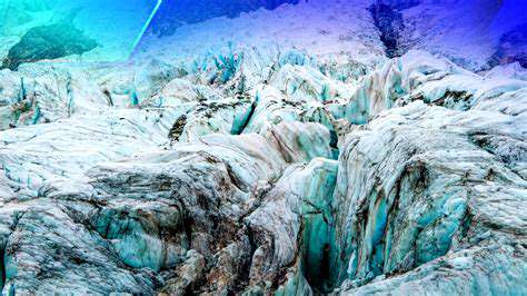
Beyond the basic measurement of elevation, combining altimetry with other technologies allows for the comprehensive monitoring of environmental changes. This includes tracking deforestation, monitoring glacial melt, and assessing the impact of natural disasters. By overlaying altimetric data with other environmental factors, scientists can develop a more robust understanding of ecological systems and their response to various pressures.
Improving Infrastructure Planning and Management
Accurate topographic data is essential for infrastructure development and management. Precise elevation data empowers engineers and planners to design more effective and resilient infrastructure projects, considering factors such as drainage, slope stability, and potential flooding risks. This enhanced understanding can significantly reduce the cost and time associated with infrastructure projects.
Enhancing Modeling and Simulation
The combined data sets enable the creation of more accurate and realistic models of the terrain. These models are critical for various applications, from simulating natural hazards like landslides to predicting the behavior of water resources in a changing climate. The increased accuracy and detail in the models lead to more reliable predictions and effective mitigation strategies. In summary, the integration of altimetry with other technologies is vital for advancing our understanding and management of the environment and its resources.