Understanding Radar Interferometry
Radar interferometry is a powerful technique used in satellite monitoring of glaciers. It leverages the principle of radar waves to measure subtle surface changes with remarkable accuracy. Essentially, it compares the phase differences of radar signals reflected from the same point on a glacier's surface at different times. These minute phase shifts, often imperceptible to the naked eye, translate into precise measurements of elevation changes, offering invaluable insights into glacier dynamics.
The process involves sophisticated signal processing techniques to extract information about the surface displacements. This allows researchers to quantify the rate of ice flow, identify areas of accelerated melting, and understand the complex interplay of factors influencing glacial behavior. The ability to repeatedly monitor these changes over extended periods is crucial for understanding long-term trends and predicting future glacier responses to climate change.
Applications in Glacier Monitoring
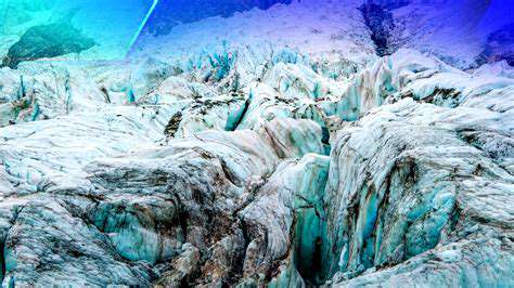
Radar interferometry plays a vital role in monitoring the health and evolution of glaciers. By measuring the precise elevation changes, scientists can identify areas of thinning, determine the velocity of ice flow, and detect calving events, all critical indicators of glacier dynamics. This information is invaluable for assessing the impacts of climate change on glaciers and for developing models to predict future glacier behavior.
Furthermore, it can be applied to study the complex processes within glaciers, such as the formation of crevasses, the movement of ice within the glacier, and the identification of potential hazards. The ability to track these changes over time provides critical data for developing strategies to manage the risks associated with glacier melt and related phenomena.
Accuracy and Precision of Measurements
The accuracy and precision of radar interferometry measurements are exceptionally high, often reaching centimeter-level precision. This level of detail is essential for identifying subtle changes in glacier surfaces that might otherwise go unnoticed. The ability to measure these minute changes allows scientists to understand the complex processes driving glacial behavior with greater clarity and confidence.
Advanced techniques and sophisticated algorithms are employed to mitigate the effects of atmospheric conditions and other factors that can introduce errors in the measurements. Through rigorous data processing and quality control, researchers can ensure the reliability and validity of the extracted information, providing a robust foundation for understanding glacier dynamics.
Data Acquisition and Processing
Satellite-based radar interferometry relies on data acquired from specialized radar instruments on board satellites. The data collected needs to be meticulously processed to extract meaningful information about glacier surface changes. This processing involves complex algorithms that account for factors like satellite orbit, atmospheric conditions, and signal noise.
The resulting data is often visualized as digital elevation models and velocity maps, which provide a comprehensive view of glacier dynamics. These visualizations are essential for scientists to analyze and interpret the data, leading to a deeper understanding of glacier behavior and the influence of external factors.
Integration with Other Monitoring Techniques
Radar interferometry is often integrated with other monitoring techniques, such as optical imagery, mass balance measurements, and hydrological models, to provide a more comprehensive understanding of glacier dynamics. This integration allows scientists to cross-reference data from different sources, enhancing the accuracy and reliability of the findings.
Combining radar interferometry with other techniques provides a more holistic view of glacier evolution and enables researchers to identify patterns and relationships that might be missed using a single approach. This interdisciplinary approach is crucial for developing robust models and predictions about glacier behavior in response to climate change.