Modern Arctic exploration heavily depends on satellite navigation networks. These systems don't just offer location data - they've become the backbone of polar research operations. Without these orbiting sentinels, tracking ice movements or coordinating rescue missions would be nearly impossible. The technology works through an intricate dance between satellites and ground receivers, calculating positions with remarkable precision even in the planet's most remote corners.
What many don't realize is how these systems have transformed polar logistics. Supply routes that once took weeks to plan now get charted in hours. This efficiency boost has directly accelerated climate research timelines, giving scientists more time to analyze critical data before conditions change.
Keeping Researchers Connected: Satellite Communications
Imagine conducting fieldwork where traditional communication infrastructure simply doesn't exist. That's the Arctic reality. Satellite networks bridge this gap, enabling real-time data transmission from research stations to laboratories worldwide. These systems use specialized orbits - some satellites remain fixed above the equator while others sweep low over the poles multiple times daily.
The implications are profound. When a team on an ice floe detects sudden melting patterns, they can immediately alert colleagues thousands of miles away. This instant connectivity has revolutionized how we respond to rapid environmental changes in the polar regions.
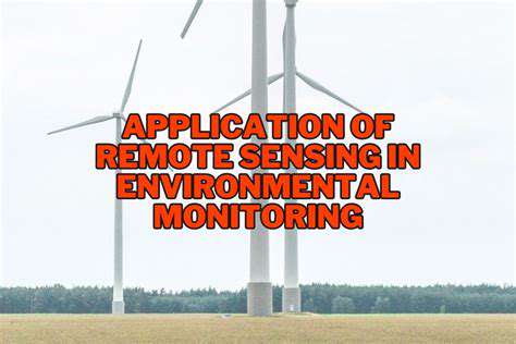
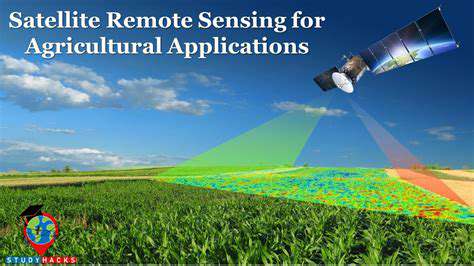
Earth's Watchful Eyes: Environmental Monitoring
Remote sensing satellites provide something invaluable - perspective. Their cameras and sensors capture changes no ground observer could see, revealing patterns across thousands of square miles. From tracking methane releases in thawing permafrost to measuring algae blooms under thinning ice, these observations paint a comprehensive picture of Arctic transformation.
Perhaps most crucially, this technology documents changes that would otherwise go unnoticed until too late. The ability to compare current images with decades-old archives creates an undeniable record of climate change's relentless march northward.
Forecasting Polar Weather
Arctic weather systems influence global climate patterns, making their study essential. Meteorological satellites track everything from polar vortex formations to sea smoke events. Their sensors detect subtle atmospheric shifts that precede major storms, giving coastal communities precious warning time.
Recent advancements allow these satellites to peer through cloud cover, revealing storm development that older systems would miss. This capability proves vital during the Arctic's long polar night when darkness renders optical observation impossible.
Decoding Ice Sheet Dynamics

Mapping the Frozen Frontier
Advanced satellite imaging has rewritten our understanding of polar ice dynamics. Modern sensors don't just show where ice exists - they reveal its structural integrity. Cracks that signal impending calving events, subtle elevation changes indicating subsurface melt channels, even the telltale signatures of different ice types all become visible from orbit.
The scale of observation matters tremendously. Where ground teams might survey a few square miles, satellites capture entire ice shelves in single passes. This comprehensive view exposes connections between distant events - how meltwater pooling in Greenland might affect glacier flow hundreds of miles away.
The Science of Ice Measurement
Determining ice thickness involves more than simple measurement. Satellite altimeters fire pulses of energy downward, timing their return to calculate surface height. But the real magic happens when scientists combine this data with gravitational measurements, revealing how mass shifts beneath the surface.
New radar systems can actually peer into ice sheets, mapping internal layers like tree rings. These ice biopsies provide climate records stretching back millennia, offering crucial context for current changes. The data shows unequivocally that today's melt rates have no historical precedent.
Climate Signals in the Ice
Ice sheets serve as Earth's climate archives, preserving evidence of atmospheric conditions across ages. Satellite analysis of ice core data (collected by ground teams at locations identified from orbit) reveals how dramatically current warming diverges from natural patterns. The signals are unmistakable - increased meltwater lubrication at glacier bases, accelerated calving rates, shrinking multi-year ice reserves.
Perhaps most alarmingly, satellites have detected previously unknown feedback loops. Darkening ice surfaces from algae growth absorb more heat, while meltwater percolation weakens ice shelf structures. These processes, once initiated, accelerate further melting in self-perpetuating cycles.
Climate Change Unveiled Through Polar Observation
The Arctic's Global Climate Role
The Arctic functions as Earth's thermostat. Its bright ice reflects sunlight back to space, while exposed ocean absorbs heat. Satellite measurements quantify this albedo effect with increasing precision, showing how shrinking ice cover reduces planetary reflectivity. The numbers are stark - some regions now absorb up to 30% more solar energy than just decades ago.
This isn't just an Arctic problem. The extra heat alters atmospheric circulation patterns, influencing weather systems across North America, Europe, and Asia. Satellite tracking of these teleconnections helps explain recent extreme weather events far from polar regions.
Innovative Observation Techniques
Modern polar satellites employ an array of specialized sensors. Microwave radiometers measure surface temperatures through clouds, while synthetic aperture radar constructs detailed topographic maps regardless of light conditions. Some experimental systems even detect minute gravitational changes as ice mass shifts.
The data deluge presents its own challenges. Advanced machine learning algorithms now sift through terabytes of daily imagery, flagging significant changes for scientist review. This automated monitoring catches subtle shifts human analysts might overlook amidst the vast data streams.
From Observation to Understanding
Raw satellite data alone tells only part of the story. Polar researchers combine these observations with ocean buoy readings, atmospheric sampling, and historical records to build comprehensive models. The resulting simulations project future scenarios with improving accuracy, though the trends consistently point toward accelerating change.
The models reveal disturbing non-linearities - thresholds beyond which changes become irreversible. Satellite data helps identify these tipping points, like the potential collapse of key ocean circulation patterns. Such warnings, while alarming, provide crucial guidance for mitigation efforts.
Shaping Our Climate Future

Forecasting With Polar Data
Climate prediction has evolved from educated guesswork to data-driven science, thanks largely to satellite observations. The Arctic's rapid transformations provide a preview of broader climate shifts, allowing modelers to test and refine their projections. Current models incorporating satellite data suggest previously underestimated feedback loops may accelerate warming beyond earlier predictions.
These forecasts inform critical decisions - from infrastructure planning to conservation strategies. Coastal cities use them to plan sea walls, while wildlife managers adjust protection efforts for species like polar bears facing habitat loss.
Mitigation Through Technology
Satellite monitoring doesn't just document problems - it guides solutions. Precise emissions tracking helps target reduction efforts, while vegetation monitoring assesses carbon sequestration projects. Some proposed geoengineering approaches rely on satellite networks to monitor potential unintended consequences.
The same technology revealing climate change now helps evaluate intervention effectiveness. When nations implement emission controls, satellites provide independent verification of their impact - a crucial accountability tool in international climate agreements.
The Human Dimension
Beyond the science, satellite data tells a human story. It documents the shrinking hunting grounds of indigenous communities, the threatened infrastructure of Arctic towns, the changing migration routes of marine mammals. These observations inform adaptation strategies for vulnerable populations.
The technology also democratizes climate knowledge. Open-access satellite data platforms allow citizens, journalists, and policymakers to see changes for themselves - transforming abstract concepts into visible reality. This transparency builds the public engagement essential for meaningful climate action.