Introduction to Satellite-Based Forest Monitoring Techniques

Satellite-Based Monitoring of Forest Cover
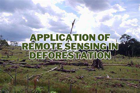
Satellite imagery has revolutionized the way we monitor and understand forest cover globally. The ability to capture vast swathes of land from space allows for consistent and regular observations, offering a unique perspective on deforestation, forest degradation, and the overall health of forest ecosystems. This remote sensing capability is crucial for assessing changes over time and identifying areas needing immediate intervention. Through the analysis of spectral data, scientists can distinguish different types of vegetation, providing valuable insights into the biodiversity and structural complexity of forests.
Various satellite platforms, equipped with sophisticated sensors, are employed to collect this data. These platforms orbit the Earth, capturing images at specific intervals, allowing for the generation of time series data. This repeated coverage is essential for tracking forest dynamics, such as the rate of deforestation, the spread of diseases, and the impact of natural disturbances. The resulting data are then processed and analyzed to produce valuable information for conservation efforts and land management strategies.
Applications in Forest Management
Satellite-based forest monitoring provides crucial information for forest managers. Identifying areas of deforestation and forest degradation is paramount for implementing effective conservation strategies. By tracking changes in forest cover, managers can anticipate future challenges and take proactive measures to mitigate negative impacts. The data also aid in the assessment of forest health, enabling the identification of areas affected by diseases or pests, allowing for targeted interventions.
Furthermore, satellite imagery plays a significant role in monitoring the effectiveness of forest management practices. The consistent data allows for the evaluation of the outcomes of reforestation and afforestation projects. This real-time monitoring capability ensures that forest management efforts are achieving their intended goals, and adjustments can be made to maximize their effectiveness. Understanding the impact of logging practices on forest structure and regeneration is another critical application.
Challenges and Limitations
While satellite-based forest monitoring offers immense potential, it is not without its limitations. The resolution of satellite imagery can sometimes be insufficient for detailed analysis of smaller-scale forest features. Cloud cover and other atmospheric conditions can obstruct data acquisition in certain regions and time periods, leading to data gaps. Processing and interpreting the vast amounts of data collected by satellites require sophisticated algorithms and specialized expertise. Furthermore, accurate interpretation requires a comprehensive understanding of the local context and vegetation types.
Ensuring data quality and consistency over long periods is also a significant challenge. Different satellite sensors and platforms may have varying spectral characteristics and resolutions, which can affect the comparability of data collected over time. Addressing these limitations is crucial to ensuring the reliability and accuracy of satellite-based forest monitoring data.
Future Directions and Advancements
Future advancements in satellite technology promise to enhance the capabilities of forest monitoring. Improved sensor resolution, increased data acquisition frequency, and advancements in data processing techniques will lead to more detailed and timely information regarding forest cover. This will result in more accurate assessments of forest health and dynamics, allowing for more effective conservation strategies.
Integrating satellite data with other sources of information, such as ground-based observations and ecological models, will further enhance the understanding of complex forest ecosystems. This integrated approach will provide a more holistic picture of forest dynamics and allow for more comprehensive conservation planning. This collaboration will pave the way for a stronger understanding of the intricate relationship between forests and their surrounding environment.

Benefits of Utilizing Satellite Data for Forest Management
Improved Forest Monitoring and Assessment
Satellite data offers a powerful tool for monitoring forest health and changes over time. High-resolution imagery allows for detailed assessments of forest cover, canopy density, and the identification of disturbances like deforestation, fires, and disease outbreaks. This detailed monitoring enables forest managers to quickly identify and respond to emerging threats, ensuring proactive management and minimizing negative impacts on forest ecosystems. Early detection of issues is crucial for effective intervention and ultimately, forest conservation.
The consistent, repetitive coverage provided by satellites allows for long-term monitoring of forest dynamics, providing a crucial historical context for understanding trends and patterns. Such insights are invaluable for evaluating the effectiveness of management strategies and adapting to changing environmental conditions.
Enhanced Deforestation Detection and Prevention
Satellite imagery is exceptionally effective in detecting deforestation events, even in remote and challenging terrain. The ability to track changes in forest cover over time allows for the identification of illegal logging and agricultural encroachment, enabling swift intervention to prevent further degradation. This proactive approach to deforestation is crucial for maintaining biodiversity and preserving valuable forest resources.
The immediate identification of deforestation events via satellite imagery allows for prompt enforcement actions, aiding in the prevention of further environmental damage and the protection of forest ecosystems. This technology is invaluable in the fight against illegal logging and unsustainable land-use practices.
Precise Biomass Estimation and Carbon Accounting
Satellite-derived data allows for the precise estimation of forest biomass, a critical component in carbon accounting. By measuring forest canopy height and density, satellites provide valuable data for calculating the amount of carbon stored in the forest. This information is crucial for understanding the role of forests in global carbon cycles and for implementing effective carbon offsetting strategies. Accurate estimations enable better policies and management practices regarding forest conservation and carbon sequestration.
Improved Resource Management and Planning
Satellite data facilitates informed resource management decisions, enabling efficient allocation of resources for forest protection and development. By identifying areas of high biodiversity, or those experiencing degradation, managers can prioritize conservation efforts and allocate resources effectively. This data-driven approach to resource management optimizes outcomes and ensures sustainable practices.
Optimized Fire Management and Prevention
Satellite data plays a critical role in detecting and monitoring forest fires. Real-time imagery enables rapid identification of fire hotspots, allowing for the deployment of firefighting resources to the affected areas as quickly as possible. This proactive response can significantly reduce the extent and impact of forest fires, minimizing the loss of lives, property, and critical ecosystems. The ability to analyze historical fire patterns helps in developing targeted fire prevention strategies.
Sustainable Forest Harvesting and Reforestation
Satellite data can be used to monitor and evaluate the impact of forest harvesting activities. The ability to track changes in forest cover and structure allows for the assessment of harvesting practices against sustainability standards. This data also proves useful in monitoring the progress of reforestation efforts, ensuring that replanting initiatives are successful and contribute to overall forest health and resilience. Accurate monitoring is essential for ensuring that harvesting operations are sustainable and do not jeopardize the long-term health of the forest ecosystem.