Introduction to Satellite Technology in Geospatial Analysis
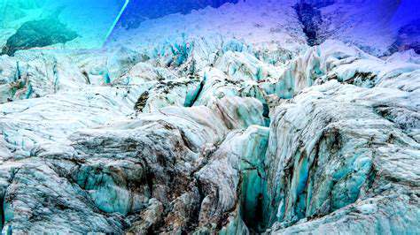
Satellite Imagery for Landslide Detection
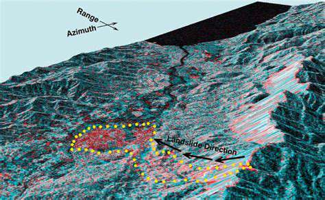
Modern satellite imagery has transformed how we detect and monitor landslides, providing perspectives that ground-based methods often miss. Sensors like Landsat and Sentinel-2 capture high-resolution details, revealing subtle slope instability indicators such as cracks or unusual vegetation patterns. These visual cues, frequently overlooked by human observers, enable researchers to identify potential risks early, allowing for timely interventions to reduce hazards.
Regular satellite revisits offer unparalleled monitoring of landslide evolution. Tracking changes in land cover, surface deformation, and debris movement provides critical insights into ongoing processes. This temporal dimension is indispensable for understanding landslide dynamics, improving risk assessments, and developing targeted mitigation approaches.
Remote Sensing Techniques for Landslide Characterization
Satellite data goes beyond detection, enabling detailed landslide analysis. Advanced techniques like spectral analysis help determine landslide types, material volumes, and movement speeds. For example, distinct spectral signatures differentiate affected areas from stable terrain and even identify specific materials within landslide deposits.
Digital elevation models (DEMs) derived from satellites revolutionize slope stability assessment. These 3D terrain representations allow precise calculation of slope angles and aspects, crucial for identifying vulnerable areas. When combined with other satellite data, DEMs significantly enhance landslide characterization accuracy.
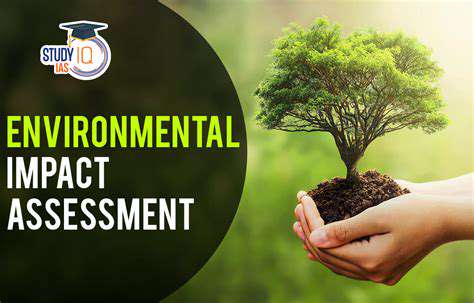
Applications of Satellite Data in Landslide Risk Assessment
Satellite-based information forms the backbone of comprehensive risk assessments. Integrating imagery with geological data, rainfall records, and historical events creates complete risk profiles. This holistic approach pinpoints high-risk zones, guiding resource allocation for maximum impact. Predictive modeling further refines these assessments, enabling targeted prevention strategies.
Post-disaster satellite analysis proves equally valuable. Rapid damage assessment, recovery monitoring, and impact evaluation all benefit from orbital perspectives. This capability streamlines resource distribution, accelerating community recovery after landslide events.
Satellite Navigation for Landslide Monitoring
GNSS systems like GPS provide millimeter-level landslide movement tracking. Ground-based or aerial receivers monitor displacement in real-time, offering critical data on movement rates and directions. This continuous surveillance enables early warning systems, particularly crucial for impending catastrophic events.
When combined with imagery and DEMs, navigation data yields comprehensive landslide behavior insights. This integration creates superior prediction models, especially valuable for remote locations where traditional monitoring proves impractical.
Utilizing Satellite Imagery for Landslide Detection
Utilizing Satellite Imagery for Land Cover Mapping
Orbital imaging systems excel at comprehensive land cover mapping, providing consistent large-area monitoring. This capability enables vegetation change tracking, deforestation identification, and urban expansion analysis. The combination of extensive coverage and regular updates surpasses traditional ground surveys, creating dynamic maps for ecosystem impact assessment.
Multispectral and hyperspectral sensors offer nuanced land cover analysis. By examining material-specific spectral responses, these systems achieve precise classification of forests, crops, and water features.
Applications in Agriculture
Agricultural operations increasingly rely on satellite-derived insights for crop health monitoring and yield forecasting. Data-driven decisions optimize irrigation, fertilization, and pest control, boosting both productivity and sustainability. Early stress detection proves particularly valuable in variable climate regions.
Urban Planning and Development
City planners utilize orbital imagery to track growth patterns and infrastructure needs. Long-term urban change monitoring reveals development trends, informing sustainable planning decisions. High-resolution data facilitates detailed analysis of urban ecosystems and land use evolution.
Cutting-edge satellite systems provide the resolution needed for thorough urban studies, including environmental impact assessments and infrastructure planning.
Environmental Monitoring
From deforestation tracking to water quality assessment, satellites serve as essential environmental sentinels. Large-scale temporal analysis reveals critical change patterns, supporting evidence-based policy making. These systems effectively monitor illegal logging and pollution sources.
Disaster Response and Management
Rapid post-disaster imaging enables efficient damage assessment and relief coordination. Timely high-resolution data directs life-saving resource allocation, while comprehensive damage analysis informs recovery planning.
Coastal Zone Management
Satellites provide the long-term perspective needed for effective coastal monitoring. Erosion pattern identification protects vulnerable communities, while sediment transport analysis informs management strategies.
Monitoring of Protected Areas
Orbital surveillance safeguards conservation areas by detecting illegal activities and tracking ecosystem health. Continuous monitoring evaluates conservation effectiveness, allowing adaptive management approaches.
Applications and Future Directions
Enhanced Mobile Experiences
Modern applications focus on intuitive interfaces and cross-device integration. Evolving user expectations demand continuous innovation, with real-time data processing enabling dynamic responsiveness.
Data Security and Privacy
As data collection grows, robust protection measures become essential. Encryption and multi-factor authentication safeguard sensitive information, while regular audits maintain system integrity.
Artificial Intelligence Integration
AI transforms mobile interactions through personalization and automation. Ethical implementation remains paramount as these technologies advance.
Internet of Things (IoT) Integration
IoT connectivity enables smart environments and remote control. Secure communication protocols ensure reliable operation of interconnected systems.
Augmented Reality (AR) and Virtual Reality (VR)
Immersive technologies redefine multiple sectors. Specialized development skills drive innovation in these transformative fields.
Improved Accessibility
Inclusive design principles ensure universal access. Adaptive features accommodate diverse user needs, creating equitable digital experiences.
Cloud Computing and Scalability
Cloud infrastructure supports application growth. Flexible resources handle expanding demands, while collaborative platforms accelerate development.