Challenges and Future Directions
Data Acquisition and Processing Challenges
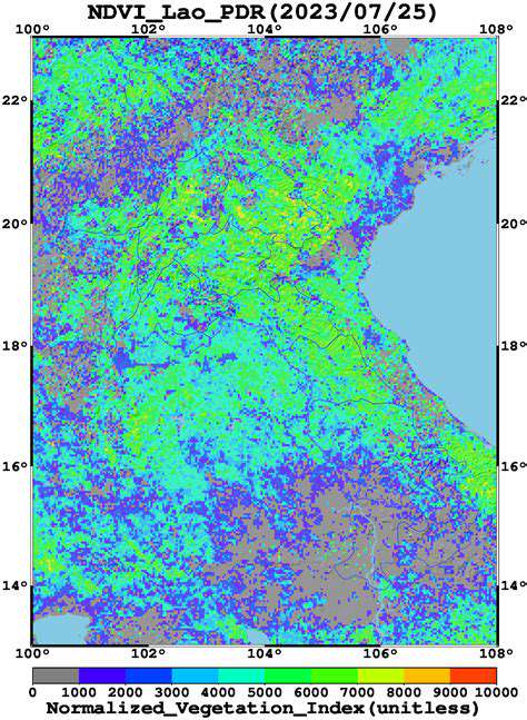
Processing vast quantities of data from Earth observation satellites presents a significant hurdle. The sheer volume of information collected, often spanning different spectral bands and spatial resolutions, necessitates sophisticated data processing techniques. Developing robust and efficient algorithms for data pre-processing, including atmospheric correction, radiometric calibration, and geometric rectification, is crucial for accurate analysis. Moreover, the heterogeneity of sensor data acquired by various satellite platforms demands standardized data formats and interoperability protocols for seamless integration and analysis.
Furthermore, ensuring the quality and reliability of the data is paramount. Errors in data acquisition, transmission, and processing can lead to inaccurate results, impacting the reliability of scientific findings and policy decisions. Developing rigorous quality control procedures and incorporating error assessments are essential for building confidence in the derived information.
Addressing Cloud Cover and Shadowing Issues
Cloud cover and shadows are ubiquitous challenges in Earth observation, significantly impacting the availability of clear, unobstructed views of the Earth's surface. Cloud-masking algorithms and techniques for filling in gaps caused by shadows are essential for comprehensive monitoring. Advancements in cloud detection algorithms, using various techniques like machine learning and sophisticated statistical models, are crucial for minimizing data loss and maximizing the return on investment in satellite missions.
Innovative methods for dealing with these atmospheric effects are continuously being developed. These include advanced algorithms for cloud filtering and shadow removal, enabling more accurate and complete analyses of Earth's surface features, from agriculture to urban development.
Improving Spatial and Temporal Resolution
Enhanced spatial and temporal resolution are key to obtaining detailed and timely information about Earth's dynamic systems. Higher spatial resolution allows for finer-grained analysis of land use changes, while higher temporal resolution enables the monitoring of rapid events like deforestation or the spread of wildfires. Future advancements in satellite technology, including the development of smaller, more lightweight sensors, are expected to improve these critical parameters.
Increased spatial resolution allows researchers to identify and analyze smaller-scale features, providing a greater understanding of the intricate processes shaping our planet. Likewise, higher temporal resolution allows for the detection of more subtle changes and trends, essential for monitoring environmental changes over time.
Integration with Other Data Sources
Combining Earth observation data with other relevant datasets, such as ground-based observations, climate models, and socioeconomic data, is essential for a more comprehensive understanding of Earth systems. Developing seamless integration methods and data fusion techniques will be crucial for leveraging the strengths of various data sources to produce more meaningful and impactful results.
Interoperability between different datasets, whether acquired from space or from in situ measurements, is necessary for the development of more sophisticated models and predictive capabilities. This integrated approach allows for a more holistic view of Earth's complex processes, enabling better informed decision-making across various fields.
Addressing Cost and Accessibility of Data
The cost of acquiring, processing, and analyzing Earth observation data remains a significant barrier to broader adoption and utilization. Efforts to develop more affordable and accessible data acquisition and processing technologies are essential for maximizing the impact of satellite data. This includes the development of open-source tools and platforms for data analysis, making the information available to a wider range of users, including researchers, policymakers, and the public.
Promoting Collaboration and Data Sharing
Strengthening collaborations among researchers, policymakers, and international organizations is vital for maximizing the value of Earth observation data. Establishing international standards and protocols for data sharing and access is crucial to ensure that the benefits of Earth observation are broadly distributed. Promoting open access to data and fostering a collaborative environment will accelerate scientific discovery and provide valuable insights for addressing global challenges, like climate change and natural disasters.


