Glacier mass balance is a crucial concept in glaciology, representing the difference between accumulation (snowfall, ice formation) and ablation (melting, sublimation, calving) of ice over a specific period. Understanding this balance is essential for comprehending how glaciers respond to climate change and other environmental factors. A positive mass balance indicates that more ice is accumulating than is lost, leading to glacier growth, while a negative balance signifies the opposite, resulting in glacier shrinkage.
This fundamental principle forms the bedrock of glacier modeling and forecasting, allowing scientists to predict future glacier behavior and its impact on downstream environments. Detailed monitoring of mass balance is critical for understanding the intricate relationship between glaciers and the surrounding environment.
Satellite Observation Techniques for Mass Balance Assessment
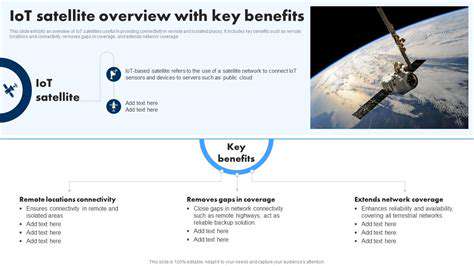
Satellite-based remote sensing techniques are revolutionizing the way we assess glacier mass balance. These methods leverage advanced technologies like radar altimetry and optical imagery to measure changes in glacier elevation and surface area. Radar altimeters precisely measure the height of the glacier surface, providing critical data on ice volume fluctuations over time.
Optical imagery, particularly from satellites like Landsat and Sentinel, allows for detailed analysis of glacier surface characteristics. Changes in surface area, snow cover, and melt patterns can be detected, offering valuable insights into the glacier's response to environmental shifts.
The Role of Satellite Altimetry in Glacier Monitoring
Satellite altimetry, a key component of satellite-based glacier mass balance studies, provides precise measurements of glacier elevation changes. By repeatedly measuring the same glacier over time, scientists can quantify the rate of ice loss or gain. These data are essential for understanding the impact of climate change on glacier dynamics.
Altimetry data, when combined with other satellite data, offers a comprehensive understanding of glacier response to varying climatic conditions. This allows for the creation of sophisticated models that predict future glacier behavior.
Optical Imagery and its Application in Glacier Mass Balance Studies
Optical imagery from satellites provides valuable information about the surface characteristics of glaciers. Analysis of snow cover extent, surface melt patterns, and changes in ice flow can offer insights into the mass balance of a glacier. This data, in conjunction with altimetry, provides a more holistic picture of glacier response to climate.
The availability of high-resolution optical imagery from various satellite platforms enables scientists to detect subtle changes in glacier morphology, which are often early indicators of mass balance shifts. This allows for timely responses and adaptation strategies.
Factors Influencing Glacier Mass Balance
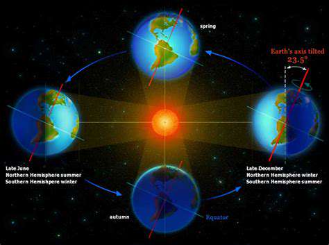
Several factors influence a glacier's mass balance, including temperature, precipitation patterns, and solar radiation. Rising global temperatures are a significant driver of glacier retreat, leading to increased ablation and negative mass balance. Changes in precipitation patterns can also impact accumulation rates, altering the overall mass balance.
Understanding how these factors interact and influence individual glaciers is crucial for accurate predictions of future glacier behavior. Furthermore, regional variations in climate patterns play a vital role in the mass balance of different glaciers.
Importance of Glacier Mass Balance in Hydrological Cycles
Glaciers play a critical role in the global hydrological cycle, acting as vital freshwater reservoirs. Changes in glacier mass balance directly impact downstream water resources, influencing river flows and water availability for human use. Understanding the mass balance of glaciers is therefore essential for effective water resource management.
Decreasing glacier mass can lead to initial increases in river flow as stored water is released. However, continued glacier retreat eventually results in a reduction of long-term water availability, posing significant challenges for communities reliant on glacial meltwater.
Future Challenges and Research Directions
Future research in satellite-based glacier mass balance studies should focus on improving the accuracy and resolution of data, enhancing the temporal coverage of observations, and developing more sophisticated models to account for complex interactions between glaciers and their environments. Addressing the challenges of cloud cover and data processing is essential to maximize the utility of satellite observations.
There is a need for improved integration of satellite data with other datasets, including meteorological records and ground-based observations, to create more robust and comprehensive analyses of glacier mass balance. This will help scientists better understand the complex dynamics of glacier systems and their response to climate change.
Remote Sensing Techniques for Glacier Mass Balance Estimation

Remote Sensing of Glacial Melt
Remote sensing plays a crucial role in monitoring glacial melt, providing valuable data on the extent and rate of ice loss. This information is essential for understanding the impacts of climate change on glaciers and the associated consequences for water resources. Satellite imagery, equipped with sophisticated sensors, offers a powerful tool for mapping changes in glacier surfaces over time, revealing patterns of retreat and accumulation. These data are often analyzed to identify areas of accelerated melt, potentially providing early warning signs of future hazards.
Various satellite platforms, such as Landsat and Sentinel, offer different spectral resolutions and temporal coverage, enabling researchers to study glacial melt at various scales and frequencies. The ability to track changes in glacier mass balance and surface elevation over extended periods is critical for developing accurate models and projections of future glacial dynamics.
Glacial Morphology and Feature Detection
Remote sensing techniques can identify various glacial features, including crevasses, moraines, and ice flow patterns. These features provide insights into the internal structure and dynamics of glaciers, allowing researchers to assess their stability and potential for future changes. By analyzing the shape and distribution of these features, scientists can understand the processes driving glacial movement and the potential for rapid ice discharge.
Image processing and analysis techniques are employed to enhance the visibility of subtle features on glacial surfaces. This allows for a more detailed understanding of glacial morphology and its evolution over time. High-resolution imagery can reveal intricate details, such as the presence of surface crevasses, providing valuable information for assessing the risk of glacial hazards.
Glacial Surface Temperature Analysis
Remote sensing data can be used to measure surface temperatures of glaciers, providing insights into the thermal regime and factors influencing melt rates. This information is critical for understanding the relationship between surface temperature, solar radiation, and ice melt. The thermal characteristics of glaciers are highly variable across different regions and under different conditions, making remote sensing a valuable tool for assessing regional variations.
The temporal variability of surface temperature data can be used to identify patterns and trends in glacial melt. This allows for the development of models that predict future melt rates and assess the potential impacts on downstream water resources. By combining thermal data with other remote sensing parameters, a more comprehensive understanding of glacial melt can be achieved.
Glacial Mass Balance Estimation
Remote sensing data, combined with models and field observations, can be used to estimate glacial mass balance. This crucial parameter indicates the net gain or loss of ice mass over a given period and is essential for assessing the overall health of glaciers. Accurate mass balance estimates are fundamental for understanding the contribution of glaciers to sea-level rise. Various algorithms and methodologies are employed to extract relevant information from remote sensing data, enabling reliable mass balance calculations.
Applications in Glacier Monitoring and Management
The findings from remote sensing studies on glacial melt are crucial for informing glacier monitoring and management strategies. This includes assessing the vulnerability of glaciers to climate change, developing early warning systems for glacial hazards, and managing water resources in glacier-fed river systems. Remote sensing data provides a crucial foundation for establishing baseline conditions and tracking changes over time, allowing for the development of proactive strategies for mitigating the impacts of glacial change. Understanding these dynamics is critical for effective resource management and adaptation to the changing environment.
Utilizing Satellite Imagery for Glacier Surface Area and Elevation Changes

Leveraging Satellite Data for Enhanced Ground Observation
Satellite imagery offers a unique perspective on Earth's surface, providing a wealth of information that can be utilized for various applications. This data, acquired from high-altitude platforms, allows for comprehensive, large-scale observations that are often inaccessible or impractical to obtain through traditional ground-based methods. This remote sensing capability proves invaluable in monitoring dynamic processes like deforestation, urban sprawl, and agricultural changes. The ability to track these transformations over time allows for valuable insights into environmental trends and human activities.
The detailed information captured by satellite imagery, including spectral data, spatial resolution, and temporal coverage, enables researchers and analysts to gain a deeper understanding of the Earth's surface features and processes. This sophisticated data processing provides crucial insights that can inform decision-making in various sectors, from environmental conservation to urban planning.
Applications in Agricultural Monitoring
Agricultural monitoring is significantly enhanced by satellite imagery. The ability to track crop health, assess irrigation needs, and identify areas vulnerable to drought or pests is critical for optimizing agricultural practices and ensuring food security. Using satellite data, farmers and agricultural professionals can make informed decisions about resource allocation, leading to increased yields and reduced environmental impact.
Environmental Impact Assessments
Satellite imagery plays a pivotal role in environmental impact assessments, providing critical data for evaluating the effects of human activities on ecosystems. By monitoring changes in land cover, deforestation rates, and water resources, researchers can assess the environmental consequences of various projects and develop mitigation strategies. This data-driven approach allows for proactive environmental management and ensures sustainable development practices.
Urban Planning and Development
Understanding urban growth patterns and development trends is crucial for effective urban planning. Satellite imagery provides a comprehensive view of urban expansion, allowing for the identification of potential challenges and opportunities. This data can be used to anticipate future needs, optimize infrastructure development, and create more sustainable urban environments.
Disaster Management and Response
In the context of disaster management, satellite imagery is indispensable. The ability to rapidly assess damage, identify affected areas, and monitor relief efforts in real time is critical for efficient disaster response. Rapid imagery acquisition enables a comprehensive understanding of the extent of damage and facilitates targeted resource allocation, saving lives and minimizing the impact of natural disasters.
Precision Mapping and Geographic Information Systems
Satellite imagery provides a crucial foundation for precision mapping and geographic information systems (GIS). By combining satellite data with other geospatial information, a comprehensive view of geographical features and processes is achievable. The high resolution and accuracy of satellite imagery enable the creation of detailed maps and models for various applications, including land management, resource allocation, and environmental monitoring. This data allows for highly accurate geographical representations that enhance understanding and decision-making.
Statistical Modeling and Data Processing Techniques
Statistical Modeling for Glacier Mass Balance
Statistical modeling plays a crucial role in analyzing satellite-based glacier mass balance data. These models help us understand the complex relationships between various factors influencing glacier change, such as temperature, precipitation, and elevation. By incorporating these factors into predictive models, we can better estimate glacier mass loss or gain over time, providing valuable insights into the impact of climate change on these vital ecosystems. Developing robust statistical models requires careful consideration of data quality, potential biases, and the limitations of the available satellite imagery. This process involves selecting appropriate statistical techniques, such as regression analysis or time series analysis, to identify patterns and trends in the data. Further, these models can be used to project future glacier behavior under different climate scenarios, enabling policymakers and researchers to make informed decisions regarding glacier management and conservation.
Different statistical methods are employed depending on the specific research questions. For instance, linear regression models can be used to investigate the relationship between glacier mass loss and temperature. More complex models, incorporating nonlinear relationships or spatial dependencies, may be necessary to capture the intricate dynamics of glacier systems. Critically, the accuracy and reliability of these models are dependent on the quality and representativeness of the satellite data used in the analysis. Thorough validation and testing of the models are essential to ensure the results are meaningful and can be reliably applied to predict future changes in glacier mass balance. Rigorous statistical methods, combined with careful data analysis, are vital for extracting meaningful information from satellite imagery and understanding the complex dynamics of glacier systems.
Data Processing Techniques for Glacier Mass Balance Studies
Effective data processing is fundamental to extracting meaningful information from satellite imagery for glacier mass balance studies. Preprocessing steps often involve correcting for atmospheric effects, such as cloud cover and atmospheric scattering, which can significantly impact the accuracy of the measurements. Geometric corrections are also essential to align the data from different satellite images and ensure consistent spatial referencing. These steps are crucial for producing reliable and comparable data across different time periods and locations. Advanced techniques like radiometric normalization and terrain correction are often required to adjust for variations in illumination and surface characteristics, enhancing the accuracy of the derived glacier mass balance estimates.
Furthermore, the processing of satellite data often involves the segmentation and delineation of glaciers from surrounding terrain. Algorithms for glacier delineation and change detection are crucial for accurately quantifying glacier area and volume changes. These techniques are often computationally intensive and require significant expertise in remote sensing. The use of advanced algorithms and sophisticated software packages is critical to ensure the accuracy and efficiency of the data processing. Proper documentation and validation of the processing steps are equally important to ensure the reliability and reproducibility of the results.
Future Directions and Applications of Satellite-Based Monitoring

Expanding Horizons in AI
Artificial intelligence is rapidly evolving, and its potential applications are expanding across numerous sectors. From autonomous vehicles to sophisticated medical diagnoses, AI is poised to revolutionize the way we live and work. This transformative technology holds the key to tackling complex global challenges, from climate change to resource scarcity.
The future of AI will likely involve even greater integration with human capabilities. This symbiotic relationship could lead to more efficient and effective problem-solving in diverse fields, including scientific research, engineering, and creative endeavors. The potential for personalized experiences tailored to individual needs and preferences is also significant.
Enhanced Automation and Efficiency
AI-powered automation promises to significantly enhance efficiency across various industries. Manufacturing processes can be optimized for speed and precision, leading to reduced costs and increased output. Furthermore, repetitive tasks can be automated, freeing up human workers to focus on more creative and strategic endeavors.
In the service industry, AI-driven chatbots and virtual assistants can provide instant customer support, leading to improved customer satisfaction and reduced response times. The ability to automate complex processes will likely lead to significant cost savings and increased productivity across a wide range of industries.
Personalized Learning and Education
AI has the potential to revolutionize education by providing personalized learning experiences tailored to individual student needs. By analyzing student performance and identifying areas requiring reinforcement, AI can adapt the curriculum and learning pace to maximize educational outcomes. This approach can cater to diverse learning styles and promote a more engaging and effective learning environment.
Revolutionizing Healthcare and Medicine
The application of AI in healthcare is poised to transform the way medical diagnoses are made and treatments are administered. AI algorithms can analyze medical images with unparalleled accuracy, aiding in early detection of diseases like cancer and other abnormalities. This ability to process large datasets of patient information will allow for more accurate diagnoses and personalized treatment plans.
Moreover, AI-powered drug discovery processes can accelerate the development of new treatments and therapies, potentially leading to breakthroughs in combating various diseases.
Ethical Considerations and Responsible Development
As AI continues to advance, it's crucial to address the ethical considerations surrounding its development and deployment. Discussions about data privacy, algorithmic bias, and job displacement must be actively pursued to ensure responsible development. These considerations are vital in ensuring that AI benefits all members of society, rather than exacerbating existing inequalities.
Careful attention to the societal impact of AI is essential. This includes developing guidelines and regulations for the ethical use of AI, as well as fostering public understanding and dialogue around the potential benefits and risks.
